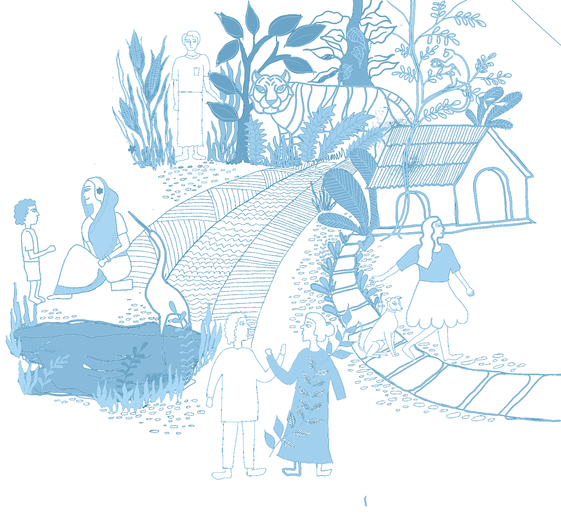
“People for people” poses a vision for a safe, connected and compassionate community towards all genders, human and non-human. The communities that are affected newly to flash flood become adaptive in the face of disaster by getting knowledge from experienced and resilient communities. The pilot project for this vision operated in two communities, one in Pekua and the other in Shoronkhola. Community consultation workshops were organized, placing the community at the forefront to extract and document their indigenous knowledge. A couple of teachers from the resilient community in Shoronkhola, were inspired to establish connections with the newly affected community dealing with flash floods. They shared their experiences as teachers with the newly affected community. The pilot project also explored various mediums to disseminate knowledge.
As a part of this project, four volunteers were selected to be a part of this experience. All four volunteers stem from an architecture and planning background and brought valuable insights into the learning process. This document provides a compilation of their critical reflections.
Ishmat Ara
The projects involved two different disaster-prone communities, each facing distinct disaster scenarios and employing different coping mechanisms. Shoronkhola, situated beside the Baleshwari River in the Bagerhat district, contends with tidal floods and storm surges. In contrast, Pekua, a village in the Cox's Bazar district, is susceptible to flash floods from the Matamohuri River.
Shoronkhola experiences floods almost every year between June and August, exacerbated by its location in a saline-prone area. The severity of the 2009 cyclonic storm "Aila" profoundly impacted the community, prompting a heightened awareness of storm signals and proactive measures to mitigate damage.
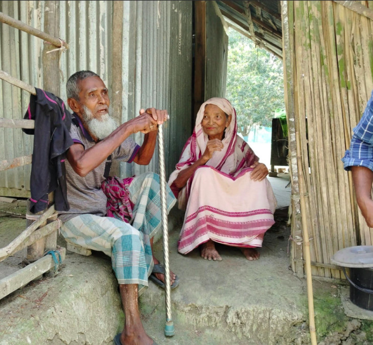
"The current and water level was so high that when my child of 3 years drifted away I couldn'trealize." - Jahangir.
Residents have since adopted various adaptation strategies, including utilizing boats for transportation during floods, constructing temporary shelters ("Tong Ghor") on embankments, maintaining access to ponds for drinking water, and employing raised house plinths. To combat salinity, they implement a vegetation technique called "Bosta Poddhoti," which involves growing plants on elevated platforms filled with soil from beneath ponds. In contrast, Pekua faces flash floods that strike without warning, leaving residents with little time to prepare or safeguard their belongings.
"Within 10 mins we saw water comes down to our land and couldn't do anything, we left thedomestic animals and houses as it is and leave with our families."- Shaheen Akhter.
Despite the absence of human casualties, the 2023 flash flood prompted community members to raise house plinths, construct brick and concrete houses, and elevate homesteads with soil and sand. While the floods bless their land with improved crop productivity due to "poli mati," they face continuous challenges in maintaining water quality and supply.
Shoronkhola endured the loss of lives and ongoing struggles with salinity, while Pekua suffered livestock loss and structural damage but benefitted from enhanced crop yields and access toclean water. Both communities prioritize local preparedness and response capacity-buildingefforts to prevent and mitigate the impacts of disasters on their communities.
(Ishmat Ara is an architect and educator, passionately exploring sustainable urban living, climate responsive design, and community engagement to foster resilient cities. With a focus on SDG Goal 11, she strives to create affordable housing solutions while advocating for climate change adaptation. Ishmat is the project’s research volunteer)
Barnaly Roy
Two communities next to each other
Bangladesh is a disaster-prone country on the world map. Our study area was two climatically vulnerable areas Shoronkhola and pekua which are in Bagerhat and Cox’s Bazar districts.
Shoronkhola is one of the most cited disaster vulnerable Upazila of Bagerhat having an exposure to the Bay of Bengal. For geographic location and weather condition, cyclone, tidal flood, erratic rainfall, cold wave, arsenic contamination, and tornado are common in this area. Shoronkhola faces at least one major natural disaster almost every year. In 2007, the devastating super cyclone ‘SIDR’ with a 20-feet tidal wave and 220-240 km/hour wind speed hit on coastal Bangladesh. Shoronkhola Upazila is one of the extremely affected areas. In 2009, just two years later of the SIDR cyclone one Aila again hit the southern coastal region where 190 people died and about 1 million people became homeless [1]. Despite these frequent natural disasters, saline intrusion, declining agriculture, and sea-level rise, people of this area are living in their place, although the frequent disasters and livelihood uncertainty choose living in this disaster-prone coastal region more difficult [2].
On the other hand, Pekua upazila of Cox's bazar district is becoming vulnerable to flash flood recently. Due to flash floods during the rainy season, the Modhumoti River's embankment sustained multiple damages, and people experienced beggar descriptions. Despite being in the coastal region of the Bay of Bengal, the area has improved soil conditions and an abundance of potable water in the underground which is better than the condition of Shoronkhola.
Adaptation Strategies of Shoronkhola vs Pekua
From my self observation, we have noticed some adaptation strategies in both Shoronkhola and Pekua. In case of shoronkhola, we have experienced several adaptation strategies about their homestead planning, built form height,materials and design,sanitation and vegetation system. From the community who lived inside of the embankment, we have acknowledged-
“We usually raise the plinth of the houses around 3’-4’ from the ground level. Due to extreme saltine intrusion, most of the time, water scarcity is very acute in our area. For household activities, we are mostly dependent on individual pond water. But for drinking water, we collect rainwater in the tank or other vessels during the monsoon period, and rest of the month we drink water from reserved ponds through filtration. For better sanitation, they are raising the plinth of their toilet also.”- Fatima Begum and Hemayet Molla
The people who lived in the outside of the embankment accounted -
“During the tidal surge or seasonal surge, we make “macha” or “tong” inside of the house by raising the height of the bed to survive the flood. Moreover, we usually raise the plinth of the houses from the ground level. Due to extreme saltine intrusion, most of the time we face water scarcity all year round. For both household activities and drinking purposes, we mostly depend on rainwater or river water without any filtration”- Rustom Bayati, Helena Begum, Majutun Begum
They also added that to sustain flood and saline intrusion, they use wooden powder with clay for making the building plinth. They even use disaster adaptive woods like “Shirish, Soilla Tree” etc. For better vegetation growth, recently they have been using “Bosta Poddhoti“ which can sustain during flood. Additionally, they use boats for accessibility during flood times. Further, they always help each other out with reliable flood updates and share their awareness through various interactions before the flood. So, it can be said that these strategies are very flood adaptive for Shoronkhola which gives relief to the community people from extreme suffering during or after flood.
Conversely, it is evident that Pekua experiences flash floods during periods of intense rainfall, which originate in the hills. During that season, the built environment system, vegetation, livelihood, and economy of the local people are all negatively impacted by the flash floods that destroy the village embankments. Through our involvement with the community, we have recognized that-
“In enduring the flash flood, most affluent people construct Pucca constructions with high plinths. To shelter people during floods, they have been providing Pucca roofs recently. However, there is not a major salinity or water shortage there. Instead, we are fortunate that our soil became more fertile following the flood.”- Israt Jahan, Osman, Nurul Hossain
They also mentioned that they erected their slaughterhouse next to an embankment, so they did not have to be concerned about the livestock floating away during the flood. To prevent erosion, they also grow bamboo next along the embankment. But from personal observation, we have noticed that people of Pekua are less concerned about the disaster and there is lack of awareness and knowledge about flood adaptations.
Finally we say that there are several adaptation strategies found in Shoronkhola rather than Pekua due to several types of disasters. While most people are willing to build Pucca roofs and high plinths with pucca constructions, Shoronkhola continues to thrive with its conventional building methods. Furthermore, those who are unable to afford the Pucca house are growing more vulnerable on the social and economic fronts. Sharing knowledge regarding the flood adaptation strategy helps Pekua communities more aware during flooding.
References People for People – Volunteer Reflections
[1] B. Mallick, B. Ahmed, and J. Vogt, “Living with the Risks of Cyclone Disasters in the South Western Coastal Region of Bangladesh,” Environments, vol. 4, no. 1, Feb. 2017, doi: 10.3390/environments4010013.
[2] T. Malaker, L. Islam, and S. Das, “Reason Behind Living in a Disaster-Prone Coastal Region: A case study on Sarankhola Upazila, Bangladesh,” International Journal of Humanities, Social Sciences and Education, vol. 9, no. 7, pp. 1–15, 2022, doi: 10.20431/2349-0381.0907001.
(Barnaly Roy is an architect by profession, known for her passion for community engagement and working with vulnerable populations. Alongside her architectural pursuits, she has dedicated herself to the teaching profession and spreading awareness about human settlement and sanitation issues. Her commitment to uplifting marginalized communities drives her work, making her a respected figure in both the architectural and humanitarian spheres.)
Sumaiya Khan Lubna
Ours’ is a flood prone country due to its geographic location and monsoon climate. The Bagerhat region's Shoronkhola Upazila is among the most susceptible places for these kinds of natural disasters. Shoronkhola experiences water logging and flooding issues nearly every month as a result of high tide, locally known as “joba”. Water rises to a height of one to two feet during joba and remains there for hours. The village of Shoronkhola is divided into two sections: one is situated inside the embankment and the other is outside of it. The inside of the settlement is largely protected during joba because of the height of the embankment. However, the exterior portion is extremely prone to joba, flash flood as well as storm surge. dwellings within the embankment are more apparent during storm surges and flash floods. When there is a flash flood, the water often rises two to three feet, although most of their dwellings are raised three to four feet in anticipation of similar catastrophes. Mud is used to construct the house's plinth, or base. The houses become brittle as soon as water hits the plinth because the substrate starts splitting from it. The high salinity in the groundwater around the Shoronkhola region is another major issue. The concentration of salinity is so high that there is a drastic shift in agriculture and lifestyle. This issue also contributes to soil erosion. Large trees which need excessive soil to support, tend to fall during floods.
However, in response to their issues, the Shoronkhola people have a variety of tactics. Noticeably, each home has access to at least one pond that serves as a supply of drinking water. Now and then, they cut down big trees next to their houses, so they do not fall down during a storm or flood. Some of the residents have adapted a new vegetation method called “Bosta Poddhoti” where they do plantation in a sack and put it on a bench made of bamboo or tree trunk. They have adapted three scale adaptation strategies for the flood. The macro scale adaptation, which is the Village level adaptation, the meso scale adaptation which is the homestead level and the micro scale adaptation which refers to individual houses. The following diagram describes adaptation methods in various scale levels.
On the other side of the country, in Cox’s Bazar region, lies the Pekua Upazila. It has recently faced flash floods and is learning how to cope with it. The Pekua community have already begun to raise their house plinths. However, the disparities in built forms within the community are what really set them apart. Affluent people are constructing pucca houses using brick and concrete instead of mud and tin homes. In their opinion, shifting to the first level seems more practical when faced with floodwaters. Households and domestic animals are all saved this way. Additionally, there is an abundance of freshwater and no salinity in the floodwaters. Thus, there was an enormous increase in crop productivity following the flood situation. However, there is a lack of awareness when it comes to taking shelter during emergencies. During disasters, people rarely relocate to safe refuges or shelters.
However, moving to a safer place has been the first solution while facing any disaster. As Shoronkhola has faced floods most often, and lost not only houses but lives, they tend to move to a shelter and mark themselves safe. One can never know what measures he is going to take, until he does not face a problem. So, adaptation strategies are also highly dependable to the context, community and their way of life. But, if Pekua takes awareness as a first choice to their flood issue, the community can be more resilient.
Sumaiya Khan Lubna stands in the vibrant intersection of architecture and education as a dedicated architect and teacher with a profound passion for sustainable design and climate change adaptation strategies. She skillfully combines her responsibilities as a professional with an uncompromising dedication to promoting positive change towards the communities.
Fattah Ahmed
The selection of spaces for scrutiny often hinges upon the intrinsic qualities they possess, shaping not only their physical attributes but also the mental fortitude of their inhabitants. In this critical reflection, we delve into the contrasting landscapes of Shoronkhola and Pekua, symbolizing soil enriched with salt and soil of sands, respectively. Through the lens of the Survey Activity on 30 Days, we explore how the unique environmental characteristics of these regions influence the mental resilience of their communities.
Shoronkhola, with its proximity to water bodies and fertile soil imbued with salt, represents a landscape entrenched in resilience and adaptation. The exploration of cultural beliefs, housing practices, and Sundarbans reliance unveils a community deeply connected to its surroundings. Despite the constant threat of floods, Shoronkhola exhibits a remarkable sense of fortitude, evident in its strategies like "Tong Ghor" and relocation to higher ground during inundations. The mental strength of Shoronkhola residents emanates from their intrinsic bond with the land, shaped by generations of coexistence with nature's challenges.
Contrastingly, Pekua emerges as a landscape characterized by the barren expanse of sandy soil that is visualized by the characteristics of emerging challenges. The assessment in Mehernama, Pekua, reveals a community grappling with the harsh realities of embankment ineffectiveness and agricultural adaptations. The absence of lush vegetation and the relentless onslaught of sand pose formidable challenges to livelihood sustainability. However, amidst these adversities, the people of Pekua exhibit a resilience born out of necessity, constantly innovating and adapting to their environment. The fertile soil sometimes become a sandy one if you can not handle it, experiencing but not adapting or negotiating with it.
The comparison between Shoronkhola and Pekua illuminates the interplay between environmental dynamics and mental resilience. While Shoronkhola's soil with salt fosters a deeprooted connection and adaptive mindset, Pekua's soil of sands demands constant innovation and perseverance. Despite facing disparate challenges, both communities draw strength from their collective spirit and resourcefulness.
In conclusion, the mental strength exhibited by the inhabitants of Shoronkhola and Pekua underscores the importance of nurturing resilience in the face of adversity. While the physical landscapes may vary, their livelihoods are guided by a shared sense of determination and adaptability. By bolstering mental resilience, it becomes possible to mitigate the risks posed by environmental uncertainties and enhance the overall quality of life in these spatial domains.
Fattah Ahmed is an architect who always tries to push the physical boundary between materialistic and non-materialistic truth, especially in the elastic territoriality of the practices in space due to power politics, reflecting a career in multidimensional competitive areas like architectural design competitions and research based analytical tools as well as the technical sites.